
Learn the top tips for buying land in Madinah, and how to verify the electronic title deed (Sak), master plan approval, utility connections, land topography, and surface area before paying a deposit or completing a purchase.
The safety of buying land in Madinah begins with verifying the electronic title deed, master plan approval, matching the area and permitted usage, and inspecting the land’s physical topography, flood drainage paths, and actual utility availability. The decision is finalized by reviewing the facade orientation, street width, and plot position within the master plan before paying an earnest money deposit or signing a purchase contract.
Buying land differs significantly from buying a ready-made villa. When purchasing a villa, you can visually inspect the building and finishes, whereas with land, most risks are associated with ownership documents, municipal zoning regulations, site topography, and future construction costs.
Therefore, it is not enough for the land to be in a suitable location or at an acceptable price. You must know: Is the title deed valid? Is the plot listed within an approved master plan? What is its designated land use? Do the area and boundaries match the legal documents? And are utilities actually connectable to the specific plot, rather than just running near the general area?
محتوى المقال
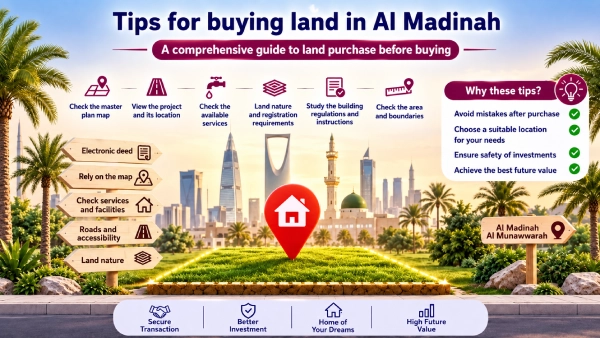
Key Tips for Buying Land in Madinah: Pre-Purchase Land Inspection Checklist
The essential pre-purchase inspection checklist includes eight key elements: the electronic title deed, master plan approval, land topography and flood drainage paths, utility services, street width and facade, permitted usage, plot position within the master plan, and matching area and boundaries.
| Inspection Item | What to Request? | Primary Verification Authority |
| Title Deed & Ownership Document | Document number, owner details, plot data, and restrictions. | Ministry of Justice or Real Estate Registry |
| Master Plan Approval | Master plan number, approval copy, and plot position. | Al-Madinah Al-Munawwarah Region Municipality & Balady Platform |
| Area & Boundaries | Survey report and side lengths (dimensions). | Balady Platform & Classified Engineering Office |
| Land Usage | Approved usage for the plot and street. | Municipality Geospatial Portal |
| Land Topography | Field inspection, topographic survey, and soil report when needed. | Engineering Office & Certified Lab |
| Flood Drain Paths | Site elevations, drainage paths, and surrounding contours. | Municipality & Specialized Engineering Office |
| Utility Services | Proof of network arrival and connection feasibility. | Relevant Utility Authorities |
| Facade & Street | Facade direction, street width, and plot boundaries. | Approved Master Plan & Survey Report |
1. How to Verify the Electronic Title Deed for the Land?
Verify the ownership document yourself and do not rely solely on a photo sent via phone. You must match the owner’s name, plot number, master plan number, area, and boundaries with the land offered to you.
The Saudi Ministry of Justice enables title deed and real estate document verification through its Real Estate Exchange services, using the document number and date or an owner’s details. If the land falls within the Real Estate In-Kind Registration zone, you must verify the ownership registration deed and real estate folio through the General Real Estate Authority services.
Before paying a deposit, request:
- Document/Title deed number.
- Document issue date.
- Owner’s full name and legal capacity.
- Master plan number and plot number.
- Land area, boundaries, and dimension lengths.
- A statement of any mortgages, liens, or registered rights on the property.
- Proof of the seller’s legal capacity to complete the sale.
Having an electronic title deed alone does not mean the deal is suitable. What is required is matching the title deed data with the actual physical site and ensuring there are no discrepancies in area, boundaries, or seller capacity.
2. How to Confirm Master Plan Approval with Madinah Municipality?
Start by verifying the master plan number and plot number through the Geospatial Portal of Al-Madinah Al-Munawwarah Region Municipality or urban maps on the Balady platform, then request a copy of the approved plan or an official document proving approval.
Al-Madinah Municipality clarifies that its geospatial portal displays the boundaries of residential master plans, approved land plots, land uses, commercial axes, and specific spatial regulations. The Balady platform also provides a service to request copies of approved plans from the municipality.
Do not settle for the phrase “the land is inside a known master plan.” Specifically ask for:
- Approved master plan number.
- Plot number within the plan.
- Plot location on the official map.
- Approved land usage for the plot.
- Street width registered in the plan.
- Any recent zoning updates or adjustments affecting the plot.
This step is vital when buying land in Madinah, as the neighborhood or plan name alone is insufficient to determine the legal zoning status of an individual plot.
3. How to Inspect Land Topography and Soil Before Purchase?
A visual inspection reveals ground slopes, backfills, and exposed rocks, but it is insufficient to determine soil bearing capacity or the type of foundations required.
The Saudi Building Code for Soil and Foundations (SBC 303) regulates the requirements for soil properties analysis, site grading, excavation, backfilling, and foundation design, including cases where a formal soil report is mandatory.
Before purchasing or setting a construction budget, review the following:
- Is the land level, or does it require cutting or backfilling?
- Are there backfills of unknown origin on the plot?
- Are there surface rocks that could increase excavation costs?
- Is the land elevation higher or lower than the street level?
- Are there signs of water pooling or erosion?
- Does the project require soil testing or boreholes?
- How will the soil nature affect the foundation design?
If your goal is building after purchase, the difference in site preparation costs can be more significant than a slight difference in land price. A lower-priced plot can become much more expensive once excavation, backfilling, and soil treatment are added.
4. How to Know if the Land is Away from Flood Drainage Paths?
Confirming that land is free from flood drainage channels cannot be done via a quick glance or marketer assertions alone. The plot position, elevations, surrounding topography, and drainage paths must be reviewed with the competent authority.
Start by identifying the exact coordinates and site position on the Madinah Municipality Geospatial Portal, then ask a specialized engineering office to review elevations, drainage paths, valleys (wadis), or nearby low-lying areas.
Pay attention to the following indicators during inspection:
- The land being lower than surrounding streets.
- Presence of nearby culverts or drainage channels.
- Signs of erosion or sediment deposits on the surface.
- Clear variances in site elevations.
- Presence of nearby low ground or a valley channel.
- Water pooling after rainfall.
These signs alone do not definitively prove the land is inside a flood path, but they warrant formal engineering and official verification before buying.
5. How to Confirm the Land is Actually Serviced with Utilities?
The presence of electricity poles or water lines within a master plan does not automatically mean every plot is ready for connection. You must distinguish between a network passing through an area and the actual feasibility of connecting utilities to a specific plot.
Ask the seller or marketer for a clear statement regarding:
- Electricity grid status and connection feasibility.
- Water network and subscription availability.
- Sewage network availability.
- Paved roads and master plan entrances.
- Rainwater drainage systems.
- Street lighting and public services.
- Fees or physical works required for connection.
Also check the locations of inspection chambers, transformers, and utility lines relative to the plot. The close proximity of certain infrastructure elements might affect the entrance, design, or practical use of the land.
Rawafed lists electricity, water, sewage, schools, mosques, parks, parking lots, and pedestrian walkways among its project features. When selecting a specific plot, always request proof of utility status around that plot and connection feasibility, rather than relying solely on the project’s general services list.
6. Why Street Width and Facade Orientation Affect Land Purchase Decisions?
Street width and facade orientation affect ease of access, building design, privacy, natural lighting, and future traffic around the property. They can also influence the land’s resale appeal.
Verify street width from the approved master plan or survey report, not by visual estimation. Then compare the facade with your needs:
- Northern Facade: May suit specific residential designs regarding shade distribution.
- Western Facade: Requires better design treatment for afternoon sunlight.
- Corner Plots (Two Facades): Offer more than one elevation, but may be subject to setback requirements.
- Wide Streets: Improve access and parking, but may mean higher traffic volume.
- Proximity to Commercial Streets: May benefit certain investments, but does not automatically convert residential land into commercial land.
There is no single facade direction suitable for everyone. The decision depends on the building design, intended usage, family requirements, or investor strategy.
7. How to Verify Whether the Land is Residential or Commercial?
Land usage dictates what can be built and operated on the plot. Therefore, you must verify the official usage classification of the plot and street with Madinah Municipality before purchase.
Do not rely on the presence of nearby shops or advertisement descriptions. A street may be classified as commercial while the plot itself remains residential, or there may be specific restrictions regarding activity types, setbacks, and parking requirements.
Review via the Municipality Geospatial Portal:
- Plot usage classification.
- Surrounding land uses.
- Street classification.
- Commercial axes.
- Master plan boundaries.
- Active spatial regulations.
8. How to Match Land Area and Boundaries with the Title Deed?
Match the surface area stated in the ownership document with the approved master plan, survey report, and physical on-site dimensions. Do not assume the correct area is simply the largest number appearing across documents.
The Balady platform notes that a survey report can display area according to physical reality as well as according to the ownership document. The area according to the master plan also appears when reading the report’s QR code.
Request an updated survey report if there is any discrepancy or ambiguity, and review:
- Total surface area.
- Side lengths (dimensions).
- Boundary directions.
- Street widths.
- Locations of alleys or adjacent plots.
- Geographic coordinates.
- Matching plot and master plan numbers.
A slight discrepancy in one boundary length can affect parking layouts, living room sizes, or setback calculations. Any conflicts must be officially resolved prior to deed transfer (Ifragh).
What is the Difference Between Buying Residential and Commercial Land?
Residential land is typically purchased to build a private home or residential project within approved zoning limits. Commercial land is tied to operating specific commercial activities based on site classification, street zoning, and applicable regulations.
| Comparison Element | Residential Land | Commercial Land |
| Primary Goal | Building a house or residential project. | Operating a commercial business or investment project. |
| Top Buyer Priority | Location quietness, services, and privacy. | Traffic flow, accessibility, visibility, and parking. |
| Key Verification Point | Plot suitability for residential floor plans. | Usage suitability for the required commercial activity. |
| Usage Source | Municipality and approved master plan. | Municipality, street classification, and activity rules. |
| Key Risks | Construction costs, utility connectivity, and soil. | Activity licensing rules, parking ratios, and access. |
Do not buy land at a commercial price simply because it is close to a busy street. First verify that the official zoning allows the exact activity on which you base your investment decision.
How to Choose the Land Location Within a Master Plan?
The best plot is not necessarily the closest to the master plan entrance or the one situated on the widest street. The correct choice balances accessibility, quietness, services, plot shape, and building plans.
Compare plots according to the following elements:
- Plot Position Relative to Entrances: Proximity to the entrance reduces travel time, but may increase traffic and noise. An internal plot may be quieter but requires a longer drive through side streets.
- Land Shape and Dimensions: Regular rectangular land is generally easier for building and parking distribution than irregular angular plots. Compare facade width and plot depth, not area alone.
- Proximity to Services: Moderate closeness to a mosque, park, or school can be a major advantage for a family, while being directly adjacent may mean congestion during peak times.
- Location Relative to Utilities & Transformers: Check the positions of electrical transformers, service rooms, drainage basins, and public parking to ensure they do not obstruct your proposed driveway or entrance.
- Access to Main Roads: Request the direct location link for the plot itself, then test the drive to work, schools, and services at different times of day.
How to Evaluate Land Price Before Purchase?
Compare the land with similar registered transactions and plots within the same master plan or immediate area, adjusting for differences in usage, area, street width, facade orientation, and utility readiness.
Price per square meter alone is insufficient. A higher-priced plot may be more cost-effective if it is regularly shaped, serviced, and requires no major grading works. Conversely, a lower-priced plot might prove expensive after factoring in excavation, backfill, and utility extension costs.
Before making a purchase offer:
- Define the land’s intended usage.
- Gather data on similar plots in location and size.
- Review available official transaction data and market indicators.
- Exclude non-comparable ad listings.
- Factor in grading, soil treatment, and utility costs.
- Calculate total acquisition and building costs, not just the raw land price.
Why Consider Rawafed Lands Among Purchase Options?
Rawafed Real Estate offers land plots in the Ruba Al-Bashaer Master Plan located in the Al-Jassah neighborhood in Madinah. It lists available public services on its lands page, including electricity, water, sewage, schools, mosques, parks, parking spaces, and pedestrian paths.
However, a safe selection requires reviewing official documentation. When inspecting an available plot, request a file containing:
- Title deed details / Electronic Sak data.
- Master plan number and plot number.
- Proof of master plan approval.
- Survey report and plot dimensions.
- Approved land usage classification.
- Street width and facade direction.
- Utility status immediately surrounding the plot.
- Exact GPS location link.
- Deed transfer (Ifragh) procedures and transaction requirements.
You can visit Rawafed’s lands page in Madinah to review details of the Ruba Al-Bashaer plan and request official documents for available plots prior to reserving.
Does a Ready Title Deed Mean Immediate Property Transfer (Ifragh)?
A ready electronic title deed facilitates ownership transfer procedures, but does not guarantee instantaneous execution. Real Estate Exchange terms specify that a sale is only completed and legally binding after full payment of the price and completion of all regulatory requirements. The Ministry of Justice provides 24/7 electronic deed transfer services.
Therefore, you must verify the eligibility of the title deed, seller, and buyer, complete the payment and regulatory requirements, and confirm there are no registered restrictions blocking the transaction.
Quick Checklist Before Paying a Land Deposit
Do not pay an earnest money deposit before receiving documented answers to the following:
- [ ] Have you verified the ownership document via the official platform?
- [ ] Does the seller’s name match the ownership document?
- [ ] Are the plot number and master plan number correct?
- [ ] Is the master plan approved by the municipality?
- [ ] Is the land usage residential or commercial?
- [ ] Do the area and side dimensions match across all documents?
- [ ] Have you reviewed site elevations and water drainage paths?
- [ ] Does the land require a soil report or grading work?
- [ ] Are utility services connectable to the specific plot?
- [ ] Are street width and facade orientation documented?
- [ ] Have you inspected the land on-site in person?
- [ ] Are deposit refund conditions clearly written?
- [ ] Do you know the exact deed transfer (Ifragh) and payment steps?
Book a Viewing for Serviced Land in Madinah
An on-site field inspection helps you evaluate the plot’s location, shape, facade orientation, street width, and surrounding services before making a decision.
Ask the Rawafed team for data on available plots in the Ruba Al-Bashaer Master Plan, the location link, and ownership/plan documents, then compare them against the checklist in this guide.
(Contact Rawafed Real Estate to book a land viewing in Madinah).
Frequently Asked Questions About Buying Land in Madinah
How do I know if the land is serviced with utilities?
Request proof of electricity, water, sewage, and paved road status for the specific plot, and verify with the relevant utility authority. Network presence in the general master plan does not automatically mean connection is ready without extra work or fees.
Why is checking flood drainage paths important before buying land?
Verifying elevations and water drainage paths helps identify risks of water pooling or natural wadi streams affecting the site. You should review municipal data and consult an engineering office; looking at dry land in clear weather is not enough.
How do I know if the land title deed is electronic?
Request the title deed number and issue date, then use the Real Estate Title Deed Verification service provided by the Ministry of Justice. If the land is registered under the in-kind system, verify the ownership registration deed via the General Real Estate Authority.
Is real estate deed transfer (Ifragh) instantaneous?
Real estate deed transfer is available electronically 24/7, but completion depends on fulfilling transaction requirements, paying the full purchase price, and verifying party/property data. Instant transfer cannot be guaranteed prior to reviewing deed and transaction status.
Can I rely on the land area stated in an advertisement?
No. You must match advertised dimensions with the ownership document, approved master plan, and official survey report. Any discrepancies must be officially resolved before purchase or deed transfer.
Is commercial land a better investment than residential land?
Not necessarily. The decision depends on approved zoning, location, market demand, and development costs. Commercial land may carry complex licensing rules, whereas residential land may be more suitable for home construction or long-term investment strategies.
Conclusion
The best tips for buying land begin with inspecting legal documents before getting consumed by price or location. A safe purchase decision in Madinah relies on verifying the electronic title deed, master plan approval, and matching area and land usage, followed by reviewing land topography, flood drainage paths, utilities, street width, and facade orientation.
The clearer and more documented the land file is, the lower the likelihood of surprises after purchase or when construction begins. You can review Rawafed’s available land plots in the Ruba Al-Bashaer Master Plan, request plot documents, and book a field viewing to select the land best suited for your residential or investment goals. Feel free to contact us for guidance on the best available land options!
Contact via WhatsApp


Join The Discussion